Shebahonaning/Killarney
Killarney village is located opposite George Island, at the entrance to the North Channel of Georgian Bay, on Lake Huron.
We had no electricity until 1951. We had no road access until 1962, when the 42-km Highway 637 was built through the wilderness to link our village with Highway 69. Until that time, we traveled 22 miles over the water or across the ice to reach Manitoulin Island, where we could access supplies. We were isolated during poor weather, when the ice was making, and during spring breakup.
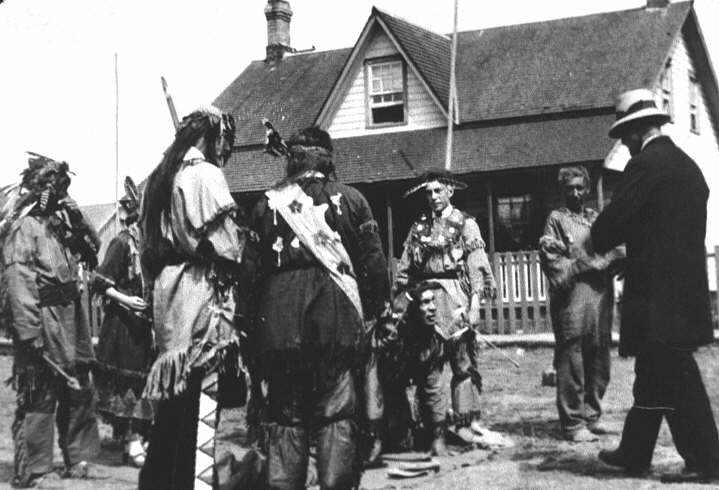
Killarney people trace their roots through Anishinaabe ancestors: the Ojibwe, the Odawa, and the Pottawatomi. Our settlement predates Treaty No. 45 (1836) and the Robinson Huron Treaty (1850) and our territory has never been surrendered. On these lands we have continued to fish, hunt, trap, gather herbs, make sugar, pick berries, cut wood, and raise our families. Over 400 of our community members are registered Indians.